Area maps (extension)
Show areas without a map service.
Combine the shapes of an open map base into areas – regional groups of a club, the districts of an association, sales territories. Each area has a name, colour, link, info text, image and contact; on the website it is an accessibilityDesigning and building websites so that everyone can use them – including people with visual, hearing or motor impairments, with a screen reader or by keyboard only.w3.org (opens in a new tab) SVG without requests to third parties.
In pictures
Pick shapes, show areas.
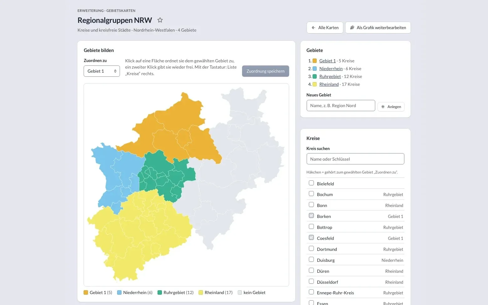
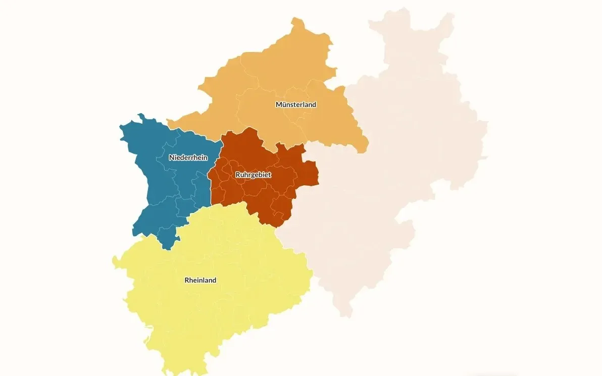
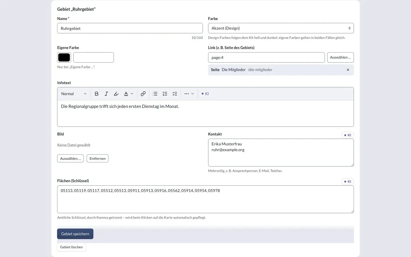
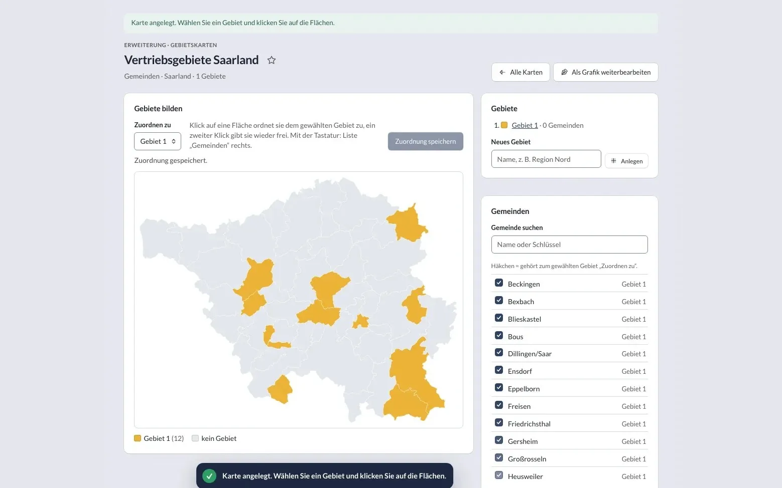
Shots from a test installation with fictitious areas and contacts (German interface) – click to enlarge. Map base: © BKG (2026) dl-de/by-2-0, simplified.
-
Building areas: a click on a district assigns it to the selected area – or use the searchable list. -
On the website: four areas made of districts, in the kitIn KLXM Studio, the package of design and building blocks for a website: layout, colours, fonts and the matching blocks. A kit can be adapted or switched – the content stays.’s colours. -
Details per area: colour, link, info text, image and contact. -
More detail: a map of municipalities, loaded per federal state.
Features
For clubs, associations and sales.
-
Open map base
German states, districts and district-free cities from the VG250 administrative areas of the Federal Agency for Cartography and Geodesy (BKG) ship with the package; municipalities are loaded per state when needed. Extent: individual states or all of Germany.
-
Building areas
A click on a shape assigns it to the selected area, a second click releases it. Alternatively use a searchable list – fully operable by keyboard.
-
Details per area
Name, colour from the kit’s design or your own, a link via the structure browser, info text, an image from the media library and contact details.
-
From data tables
One entry is one area; the shapes are names or official keys in one field. Shared tables in a network work too: each website highlights its own area.
-
“Area map” block
Overview, one highlighted area or the area of the current page; a click opens the link, an info window or nothing. Light and dark in the kit’s colours.
-
Labels
Show or hide names per area, shorten them, break lines and move them by dragging or with the arrow keys; a leader line for small areas. Font size automatically by area, contrast check in light and dark.
-
Appearance per map
Hover and focus effect subtle or animated – the area lifts softly, with “reduce motion” only a calm shadow. Plus a shadow under the map, pill labels and colours in shades of the accent colour. Existing maps stay unchanged.
-
Near you
Visitors enter a place, postcode or district; the extension finds the matching shape on your own server and hands the core the responsible area – including its website. Events and contact persons of the visitor’s region come first.
-
Accessible
Every area is a link or jump target with a name, focus is visible, names on the map have a contrast outline. A list of areas is available as an alternative – also without JavaScript.
-
No third parties
The map is rendered as SVG on your own server – no map library, no tiles and no requests to other services. No inline scripts, in line with the strict Content Security PolicyServer header that specifies from which sources a page may load scripts, styles, images and so on. It makes attacks such as cross-site scripting considerably harder.developer.mozilla.org (opens in a new tab).
-
Keep editing as a graphic
Take the map into the media library as an SVG and keep designing it in the graphics editor.
To the graphics editor: Keep editing as a graphic -
A package of its own (MIT)
composer require klxm/studio-gebietskarten, then switch it on per website under Features & extensions. Not in the core download.
On GitHub: A package of its own (MIT)
Map data
Source and licence.
Map base: Federal Agency for Cartography and Geodesy (BKG), administrative areas 1 : 250 000 (VG250), as of 1 January 2026, under the Data licence Germany – attribution – version 2.0. The attribution “© BKG (2026) dl-de/by-2-0” appears automatically below every map and in every SVG export, together with a note on the simplification.
Area maps are not street maps: for locations, addresses and zooming, use the maps of the core.
Contact
Talk to KLXM Crossmedia.
A demo, use in your project or an extension tailored to your needs – get in touch. We answer personally.
Am Schürmannshütt 40g
47441 Moers
Germany
- Phone
- +49 2841 889998-0
- info@klxm.de
- Website
- klxm.de (opens in a new tab)